
Azores the most spectacular route in Europe island Portugal
Almost all of the Earths geographical features follow each other along their route. With nearly six centuries of continuous human presence, the Azores earned an important place in the history of Portugal and the history of the Atlantic : formed in scale to the expeditions of the Discoveries and ships calling career in India , the fleet of silver , and from Brazil ; contributed to the conquest and maintenance of the Portuguese squares of North Africa ; during the succession crisis of 1580 and the Liberal Wars (1828-1834) were bulwarks of resistance; during the two World Wars , in vital strategic support for the Allied forces , remaining, to this day, a center for military and commercial aviation communications and support .
In the blue expanse of the Atlantic, Mother Nature has created a land full of natural beauty and ready to be explored: the Azores Archipelago.
To the east , on the island of Santa Maria, the beaches are warm and sandy, and the vineyards that cover the amphitheater slopes resemble stairways for giants. São Miguel, the largest island, enchants with its Sete Cidades and Fogo lagoons. The force that the earth exudes is felt in the geysers, the hot thermal waters and the volcanic lakes, as well as the tasty “Cozido das Furnas” slowly cooked inside the earth.
SANTA MARIA
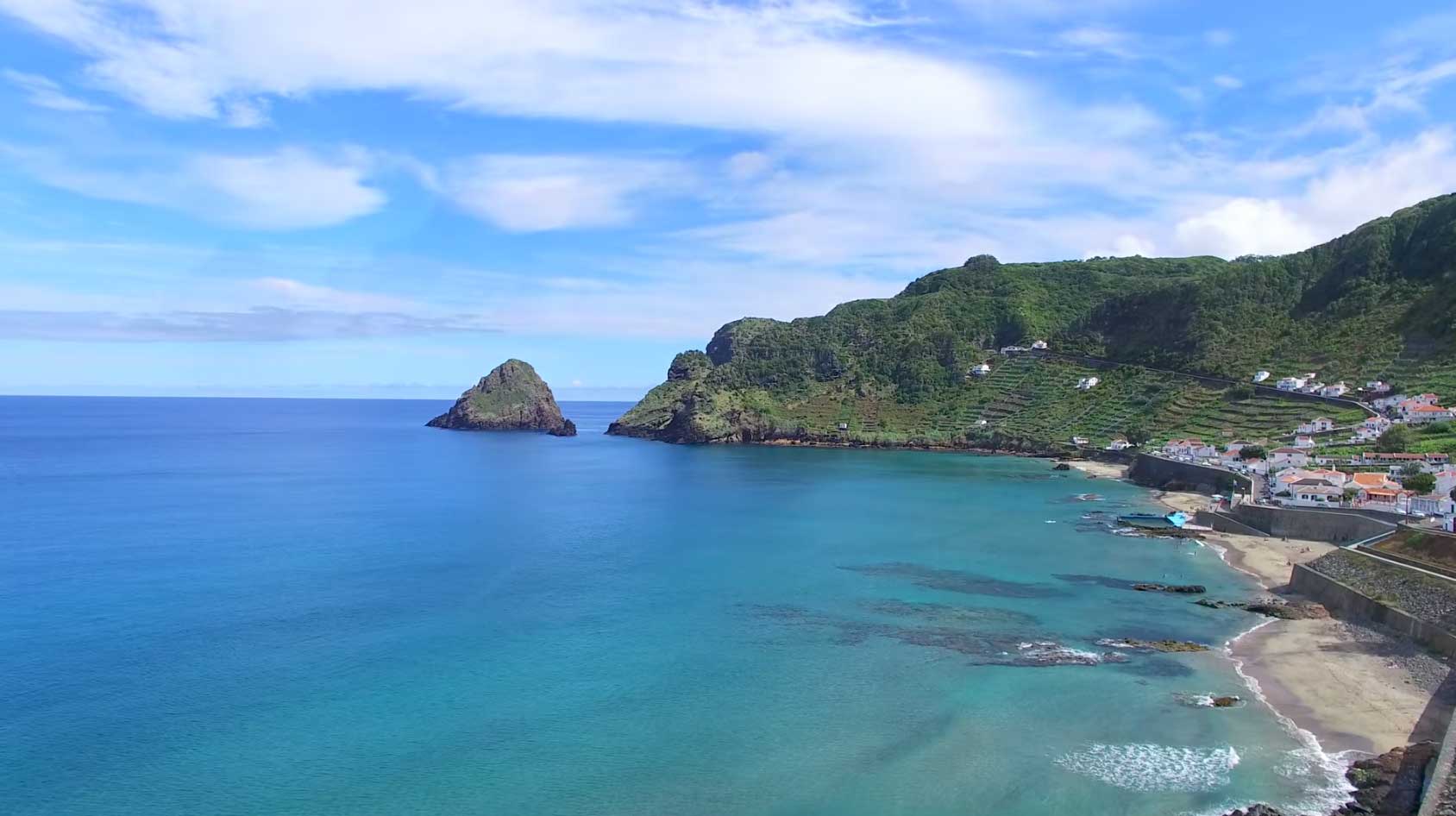
Sao Miguel
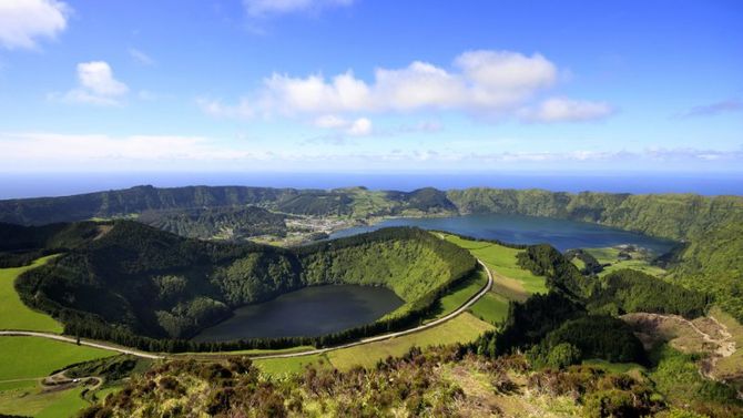
São Miguel is the largest island in the archipelago, 62.1 kilometers long and 15.8 kilometers wide. The area of 744.7 km2 is home to more than half of the Azorean population: 137,856 inhabitants (2011 data). São Miguel forms the Eastern Group of the Azores Archipelago along with Santa Maria Island, 81 km away. The highest point on the island, at 1105 m, is situated at Pico da Vara, at 37 ° 4834 north latitude and 25 ° 1240 west longitude.
THIRD

GRACEFUL

Graciosa Islands 12.5 kilometers long and 7 kilometers maximum width gives it an elongated shape from northwest to southeast. The 4 391 inhabitants (2011 data) spread over the 60.66 km2 that make up the islands surface. It is the northernmost island of the five that make up the Central Group of the Azores archipelago and the nearest island is São Jorge, 37 km away. The highest point of Graciosa Island lies at the southern edge of Caldeira da Graciosa at 405 m altitude, at coordinates 39º 01 18. 165 "north latitude and 27º 5800.29" west longitude.
CROW

The smallest island of the Azores is 6.24 kilometers long and 3.99 kilometers wide. Its oval-shaped surface extending north-south occupies an area of 17.1 km2 and is inhabited by 430 residents (2011 data). The Crow forms the Western Group of the Archipelago together with the island of Flores, which is at a distance of 17.9 kilometers. The highest point of the island, at 720 m altitude, is situated in the Estreitinho area, at 39 ° 4158 north latitude and 31 ° 0655 west longitude.
SAINT JORGE
At 54 kilometers long and 6.9 kilometers wide, São Jorge is a long volcanic mountain range stretched from northwest to southeast. Its total area is 243.9 km2 and has 9 171 inhabitants (2011 data). São Jorge Island is part of the Central Group and is one of the vertices of the so-called “triangle islands”, together with Faial and Pico, which is 18.5 km away. The highest point on the island, at an altitude of 1053 m, is located at Pico da Esperança, at 38 ° 3902 north latitude and 28 ° 0427 west longitude.
PEAK

Pico: the second largest island of the Azores, with 444.9 km2 in area and elongated shape, thanks to its 46.2 kilometers in length and 15.8 maximum width. Dominated by the Pico Mountain volcano in its western half, the island is 6 km away from neighboring Faial Island and is populated by 14 148 inhabitants (2011 data). It is the southernmost island of the Central Group of the Azores Archipelago and one of the vertices of the so-called “triangle islands”. The highest point of the island, at 2350 m altitude, is also the highest point in Portugal and is situated at Piquinho, in the Mountain, at 38 ° 2807 north latitude and 28 ° 2358 longitude
FAIAL
At 19.8 kilometers in length and 14 kilometers in maximum width, the 173.1 km2 area of Faial has a roughly pentagonal contour. It is the third most inhabited island in the archipelago with 14 994 residents (2011 data). Faial Island is part of the Central Group and is the westernmost vertex of the so-called “triangle islands”, together with São Jorge and Pico Island, which is 6 km away. The highest point of the island, at 1043 m altitude, is situated in Cabeço Gordo, in the Caldeira area, at 38 ° 3434 north latitude and 28 ° 4247 west longitude.
FLOWERS
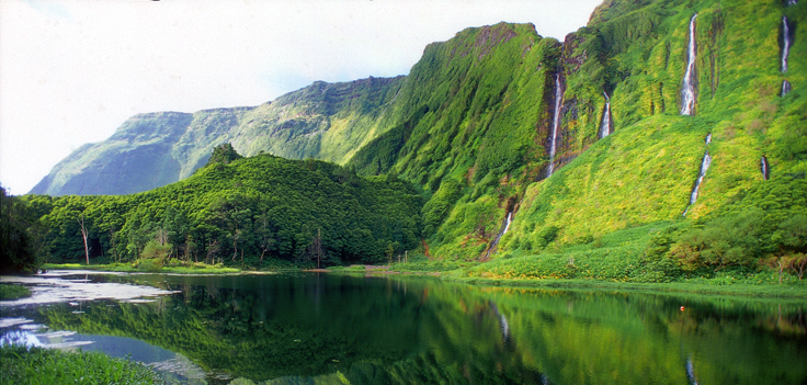
The 16.6 kilometers long and 12.2 kilometers maximum width of the island are translated into 141.4 km2 of its surface. It is on this piece of land inhabited by 3,793 people (2011 data) that the European continent has its westernmost point. Flores Island forms the Western Group of the archipelago together with Corvo Island, which is at a distance of 17.9 kilometers. The highest point on the island, at 911 m altitude, is situated at Morro Alto, at 39 ° 2748 north latitude and 31 ° 1313 west longitude.

Outros Artigos Populares no Blogue
-


Rota Vicentina is voted one of the best trails in Europe
One of the most famous trails in the world is the Rota Vicentina, which has been recognized by Leading Quality Trails - Best of Europe certification, ... -
Faro Island Beach the best beach in the region and Tourists have not yet discovered
Faro Beach is the best beach in the Faro region and is easily accessible from the city via the regular bus service that also connects you to the airpo... -
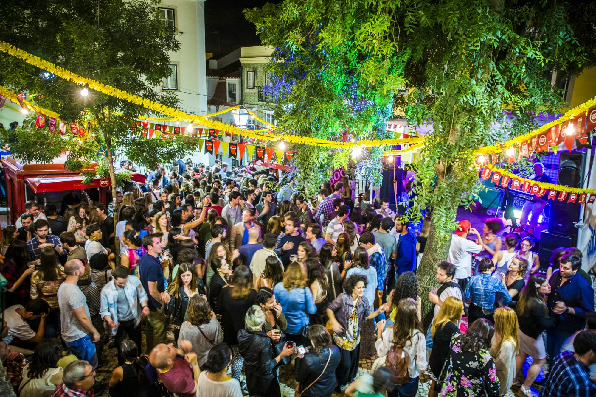
The Holidays of Lisbon begin! This year there are hundreds of free suggestions
The holidays are there and there are initiatives for all tastes. Is it too much? And what do you like? EGEAC, responsible for part of t... -
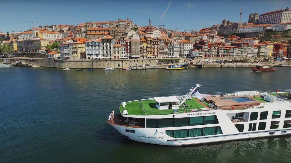
Panoramic Douro Cruise is a must-see luxury trip Portugal
Is there anything as fascinating as preparations for a long trip? There is a buzz of activity on the wharf as supplies are loaded, luggage is car... -

The 5 Best Romantic Getaways for Two in Portugal
Cozy and romantic, from north to south, Portugal is the perfect destination for a well-deserved getaway for two. Between picturesque villages, ap... -
When to go to Portugal?
We didnt know we had an April, said a Lisbon resident, "until the song came out." As a song and a season, April in Portugal is famous. Summe... -
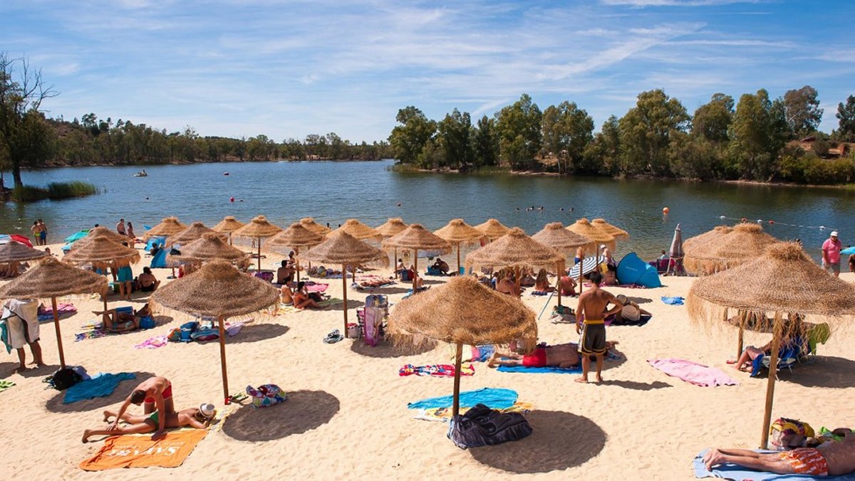
Alentejo in Portugal River Beach voted the best in Europe
The Tapada Grande River Beach in the São Domingos Mine, Mértola municipality, was elected for the first time the best European destinati... -
What to do and visit in the Alfama in Lisbon Portugal
Alfama is the oldest and one of the most typical neighborhoods of the city of Lisbon. It currently covers part of the parish of Santa Maria Mai...