
Schist Villages 27 treasures to discover in Central Portugal
The only village with a tree maternity can surprise the visitor who walks its streets
The village is of simple urban mesh, corresponding to an access that, in the beginning, is divided in three small streets that cross it and are in the exit by the access of the opposite side. The predominant building material is shale, with some constructions being towed. The door lintels are generally oak or brown.SERRA DA LOUSÃN AIGRA NOVA
All houses built with shale blocks obeyed building rules, so as to be resistant to the weather and over time. Arranged in clusters, they include two floors: the whirling floor, or first floor, and the ground floor, usually ground, which should house the cattle. However, from this rule also came the exception and several groups of corrals, or courts, were built in the vicinity of each village. Each or more of these buildings was owned by the respective community house, depending on the owners heritage and power, in cattle. The second floor also functioned as a store, a storeroom where the cereals, the carving with the olive oil, the brine with the pork, the farm implements and sometimes even had a small cellar with kites and drums. to make the wine.
It is a living village: there are vegetable gardens, there are cattle and there are many new activities that can surprise the visitor.
Watching
Tree Maternity
Space for environmental education, in the Tree Maternity Center of the Ecomuseum Schist Traditions it is possible to know and participate in the process of reproduction of indigenous species (plants, shrubs and trees). In addition to getting to know the Center, visitors can integrate environmental education programs, sponsor and contribute to tree planting campaigns.
Schist Villages Shop
In addition to selling traditional and local products, with the Schist Villages seal, it also has a bar and light meal service.
The origin of the name
The name Aigra Nova will have arisen after a designation as “backing aigra” regarding the farm or a new crop field installed when compared to the existence of another aigra (Aigra Velha). Locally, the name comes from an acrum that has the meaning of rough, bitter, hard, difficult, in reference to working and living conditions in the place.
Nature
Of the rich natural heritage that surrounds the region, stand out the Penedos de Góis and the Oitava Forest Park, habitat of endangered birds and mammals, such as deer and roe deer, which are hardly found in other parts of the country.
Story
Little is recorded about the history of this village but, by the “Register of the Kingdom population (1527)”, we know that already in the century. XVI existed at the end of the villa of Goys the then called hegra fumdeyral, where four residents lived. The name seems to indicate that at that time there would already be a "field" or "farm" that was cultivated here.
OLD AIGRA
Small village with ancient elements, allows access to a beautiful natural area that deserves to be discovered slowly and walkingEach kitchen had a hiding place between the kitchen and the corrals, which served to hide food that was considered surplus by the New State inspectors, who came to the interior villages to confiscate their food. Each house had a gate, a hole in the wall for the passage of cats. These animals were highly esteemed, as they served to kill the rodents that fed on cereals and, inside the closets, on peoples clothing. There was also, in each kitchen, a reed, structure above the fireplace / stove, which served to smoke the chestnuts in the fall, keeping them during the winter.
As we move away from the village, we can see the terrain practically without vegetation. Only here is it possible to see this. They are pasture land that is burned in summer to burst new vegetation. A few decades ago, the mountains were all that way and the villagers had to walk a long way to get firewood.
The predominant building material is schist, accompanied by scarce quartzite elements. This small village forms a group that also integrates - in a relationship of proximity and functionality - the other Schist Villages of the municipality of Góis.
The village is only equipped with minimal equipment, some in public space, others private.
To see
Claro Family Oven and Alembic Still
Private equipment, belonging to the Claro family, used for the manufacture of products (bread and honey brandy) for own consumption. Both equipment was recently restored under the ECO-ARQ project.
Tank
This is where fire prevention is stored.
Fountain
At the beginning of Quelha da Bica, a fountain permanently sings notes of fresh water flowing into the meeting, deep down in the valley, with the Pena river.
Nature
Of the rich natural heritage that surrounds these villages are the Penedos de Góis, ex-libris of the region, and the eighth forest park, habitat of endangered birds and mammals, such as deer and roe deer, which are difficult to find. found in other areas of the country.
Where is
Aigra Velha is 14 km from Góis. It is served by the EN342 (passing Comareira and Aigra Nova), which is 6 km away, and by the EN2 (passing Pena), which is 7 km away, two of which are on a dirt track that can be driven with proper driving precautions. .
The name Aigra Velha appeared after a designation as the summit aigra regarding the farm or a field of cultivation that was installed at a higher altitude when compared to the existence of another aigra (Aigra Nova).
FEATHER
A secular chestnut tree guards the entrance of this exemplary build villageA single street and several small lanes weave the urban fabric of Pena. The predominant building materials are schist and quartzite. Some facades are plastered and painted in traditional colors. Either house, built in the second half of the century. XX cannot disturb the architectural harmony of the village.
All houses built with shale blocks obeyed building rules, so as to be resistant to the weather and over time.
The village should already exist in the century. XVI, since in the "Register of the population of the Kingdom (1527)" there is in the end of the villa of Goys the existence of the so-called penalty where five residents lived.
The earliest known forms of settlement in the municipality of Góis date from the Neolithic or Bronze I period, as witnessed by the various archaeological remains and finds found north of this territory.
Alminha
It is the only element of religious vocation.
Watermill
On the left bank of the Ribeira da Pena (private).
Alembic
In the street that crosses the village (private).
Levada de Agua
Along the left bank of the Ribeira da Pena.
Fountain
In the center of the village.
Nature
Included in the Serra da Lousã Community Importance Site of the Natura 2000 Network. A monumental chestnut tree awaits us by the bridge over the Ribeira da Pena, on the banks of which, upstream and downstream, the bird cherry tree abounds.
The Pena stream is born and fed from this valley nestled west of the Penedos de Góis.
Where it is
Located on the north flank of the Lousã mountain range, next to the Penedos de Góis, overlooking the valley excavated by the Pena river, it is just 5 km from the EN2 and a total of 12 km from Góis.
The origin of the name
Pena is toponym that has Latin origin in penna, variant of pinna, meaning penha, that is, cliff or rock, characteristic situation of the surrounding the village, that is located near the quartzite crest of the Penedos de Góis. Among the various rocky outcrops, there is the so-called Penedo da Abelha, overlooking the village, on the right bank of the Pena river. It could also mean small castle building site or small defensive structure.
NEW COUPLE
From the threshing floor of the village you can see Lousã and its castleOn passing through the road, the presence of Casal Novo almost escapes us. The village develops on the slope of the slope, steeply sloping north, and the villages arboreal surroundings make it impossible to see its profile. The urban network corresponds almost exclusively to the axis created by the path that crosses the village upwards and downwards and which connects it to the Shrine of Nª Srª da Piedade. Two or three perpendicular alleys, and a few side entrances, break the continuum of constructions that, on either side, merge into each other. The predominant building material is shale, which is very dark and rough. The overwhelming majority of facades have no grout.
MEMORY
“On the day the last inhabitant got in the way, already packed, he spotted the vans that arrived to open the road and turn on the light, goals he had always fought for dozens of years” - in Serras de Portugal (1994)
To see
From the traditional and collective buildings only the source, the respective tank and the threshing floor, which is currently used as a viewpoint, remain, taking advantage of the panorama that reaches over the Lousã plain. On the horizon you can see the Montemuro mountain range.
History
It was in 1885 that the largest resident population in this village was registered: 65 inhabitants. Since 1981 the village has not registered any permanent inhabitants. Since then, almost every house has gone into second home status.
Nature
In the forest surrounding the village hide elusive deer and roe deer. The Hortas stream, at just over 2 km in length, catches water at about 900 m and discharges it at 200 m on the S. João stream. It takes a dizzying trail through a deep valley. Its waters hardly have time to contemplate the village. But he misses her for Ceira and Mondego.
The origin of the name
Casal is a term from archaic Portuguese that, in the Middle Ages, corresponded to a cluster of two or three houses in rural areas. The second element, New, tells us that this is a more recently founded settlement compared to others that are closest to it (Stye and Talasnal).
CANDAL
Typical example of land grabbing by man: all houses have been erected to ensure the best sun exposureIn the São João river basin, this amphitheater fits Candal and its river. It is nestled in the mountains of Lousã, on a hill facing south. Strategically placed next to the National Road, which connects Lousã to Castanheira de Pera, this village is used to receiving visitors. These are rewarded for going up its sloping streets, once, arrived at the viewpoint, a beautiful view of the valley presents itself, refreshed by the Candal stream. And when they come back down, the Schist Villages Lodge awaits them.
Benefiting from the privileged accessibility afforded by the National Road, Candal is often considered the most developed of the mountain villages and one of the most visited. Its usual inhabitants are often joined by holiday and weekend occupants who flock here for fresh air and good company.
The urban fabric is irregular and complex. The village develops on facing slopes and over which the houses develop as if in an amphitheater. The only structural element is the EN236 which borders the bottom. The predominant building material is shale, with facades without plaster, showing a rough appliance. The roadside houses show signs of more modern exterior, with plastered façades and painted in bold colors, but respecting the dominant feature and volume in the village.
Households and buildings housing domestic livestock are the most significant constructions. But in this village it is the look of the architectural ensemble that makes it truly unique, with the uneven contours of the buildings and the juxtaposed or even overlapping constructions contributing to a landscape of rich diversity.
Apart from housing buildings and those housing domestic livestock, Candal has no significant constructions. But the ones that exist have their history and their importance.
See
Old Former Elementary School
Built in the 1920s thanks to remittances of foreign currency sent by candalenses emigrated in the USA.
Candal Fountain
Implanted on the edge of EN236 and dating from 1941, it has a poem that ennobles it.
Alminha
It is the only religious building in the village. It is in the village square and was built by a family of candalenses as a promise payment.
Windmills
Five hydraulic mills, built in the 1920s, along the right bank of the Candal stream, harnessed the power of the water to drive the mechanism that milled the grain grains produced in the villages small banks.
Oil mill
Built in 1919, it was recently the target of recovery intervention and its operational mechanism.
Nature
Cork and chestnut trees grow close to the dwellings, tree species allowed by the old people of the mountains, valued for their cork, wood and fruits, and bird and holly take refuge in some stretches of water near the village. We can find deer in the surrounding village.
The Origin of the Name
The name Candal may be associated with the art of stoneworking. The flowerbeds — the men who work the stone — and the masons — who build walls and houses with them — sang as they did their work. “Singing the stone” may have evolved to “candar” and then to Candal, the place where the stone is sung.
History
In 1911, 129 people lived in the village. In the 1920s, emigration to the USA began, but even so, in 1940, it reached a maximum of 201 inhabitants. By this time, the village had two herds of goats and sheep, totaling 1,200 heads. In 1976, the first housing for recovery and to function as a second residence began to be purchased.
TALASNAL
Discovering this village means immersing yourself in the magical world of the Lousã mountain range and immersing yourself in lush vegetation where deer, roe deer, wild boar and many other species lurk.This is, for a long time, the Schist Village of Serra da Lousã that has given more visibility and charisma to the whole. For its size and layout, but also for the many details of the recoveries of their homes. And also by the way the village seduces us by mouth.
The fountain and the tank play the melody that accompanies our visit. The houses adorn with the branches of the vines.
The main alley follows the slope of the slope on a steep path. From it derive alley and alleyways, which create a discovery environment that everyone likes to explore waiting for the surprise of a new nook.
Here reigns the sensitive nature, which demands respect. But it allows countless possibilities for leisure and active sports. Here you can feel the pulse of the earth and its communion with men when you see the villages in the distance. They seem to have been born from schist soil, naturally, like trees.
The urban network is complex, with the houses distributed by a more south-oriented slope (most of them) and a more north-oriented slope. The predominant building material is dark shale, and almost all building facades have no grout.
Discovering this village is to immerse yourself in the magical world of the Lousã mountain range and to immerse yourself in lush vegetation where deer, roe deer, wild boar and many other species lurk.
Viewing
Alminha
the main alley, in a niche surrounded by wooden frame.
Oil
mills There were two oil mills in the village. One is in ruin. The other one, in particular, was recently recovered. They are the testimonies of the much “green gold” that was produced here.
Buying
Talasnicos
Marriage between honey and chestnut is a perfect couple in terms of conventual sweets. The baptism name given to this creation is a tribute to the village where the idea of this cookie germinated and the first trials were tested. It was fairy hands shaping this flavor that the gods inspired. Its author was Mirita Meira Santos.
Retail
is the latest confectionery creation inspired by Talasnal. These pastries, based on chestnut and almond, were created by Maria José, owner of Casa da Urze and Retalhinho.
Nature
The Serra da Lousã uniquely combines the cultural and human aspects of the Schist Villages, with nature and the leisure possibilities offered by its landscape. It is home to deer, wild boar and roe deer peeking through cork oaks, chestnut trees, oaks and of course pine trees.
It is crossed by numerous pedestrian / mountain bike trails and paths that lead us to St. António da Neve, Alto do Trevim, Lousã Castle, Mrs. da Piedade and the river beaches.
History It
reached the peak of resident population in 1911 with 129 inhabitants. Has school and two oil mills. The school was the pride of the population, who contributed to build it. Then, when it was ready, the teachers were missing, and when they came, the students were missing, until, in 1975, it was closed when only two children attended. By 1981, there were only two permanent inhabitants. Today all the early inhabitants have departed. The houses were converted into second homes, housing units or commercial establishments.
CHIQUEIRO
Only the bells of the herds contradict the feeling that time has stopped long ago.The village is bordered by two small water lines and concealed by the leafy vegetation that surrounds it. It has simple urban mesh, basically organized by two steep alleys flanked by the houses. The predominant building material is a dark shale, and, except for the chapel, no other buildings are towed. The surrounding forest and the fauna that the population makes it an ideal starting point for discovery hikes.
The villages of Casal Novo, Talasnal and Chiqueiro are quite similar from an architectural point of view, and there are essentially two types of houses. Those with only ground floor and thatched roof, which served for corrals and the two-storey dwellings, the upper, accessible by a shale staircase, a single room for accommodation, often with bread oven in the corner. The walls were made of clay and straw shale, and the structure was made of brown or pine wood.
Seeing
Chapel of Senhora da Guia
This chapel was shared by the inhabitants of Casal Novo and Talasnal. It is a schist construction of rectangular plan, plastered and painted in the corners with a blue-scarves strip.
Religious Inscription
On the facade of a house next to the chapel is a small engraved inscription. The letters “IHS” are visible, which correspond to the trigram and symbol that was used by the Society of Jesus.
History
It had its largest resident population in 1940, with 45 inhabitants. Since 1991 it maintains two inhabitants.
Nature The
holly trees at the entrance of the village are joined by the soutos in their surroundings, creating a tree frame whose colors and tones vary with the rhythm of the seasons.
The forest avifauna and the large mammals - deer, roe deer, wild boar - are abundant and easily observable here. From here, two small waterways depart to meet the Vergada stream, which runs down the slope, past the Talasnal, on its way to the S. João stream.
The origin of the name
De chico - which has the meaning of pig - plus eiró, means pig pen, pig pen or filthy place. It can be deduced that the village had a significant number of buildings and rustic buildings dedicated to animal cuts, probably owned or occupied by transhumant shepherds who, from Serra da Estrela, came to herd their cattle to Serra da Lousã.
COMMERCE
Simple but full of charms, it is a common stopping point for those visiting the river beaches.It is the smallest village in the network. It is part of the four Schist Villages of the municipality of Góis and is encompassed by the dynamics created around the Schist Traditions Ecomuseum. The village is a small group of buildings, for inhabitants and domestic livestock. Sunny all day, Comareira is made of houses nestled in each other, seeing the landscape that extends until you lose sight. The locals are proud to say that this is a strategic point for visitors to Schist Villages who are interested in the river beaches of this region or the Oitava Forest Park.
Shale and quartzite are the predominant building materials, although some facades of the buildings are lined with a characteristic curly plaster.
All houses built with shale blocks obeyed building rules in order to be weather resistant and over time. Arranged in concentrated clusters, they have two floors: the whirling floor, or first floor, and the ground floor, usually ground, which should house the cattle. In the vicinity of each village several groups of corrals were also built. These buildings were owned by the respective community house. The second floor also functioned as a store, storage area where cereals, carving with olive oil, brine with meat, agricultural implements and cellar would be stored.
Nature
It has a very irregular topography where the mountains, the hills, the valleys predominate, quite embedded. These typologies, associated with their own climate control, allowed the emergence of a very unique fauna and flora of this region.
Among the rich natural heritage are the Penedos de Góis, ex-libris of the region, and the Oitava Forest Park, habitat of endangered birds and mammals, such as deer and roe deer, which are hardly found in other parts of the country. .
History
the earliest forms of settlement that are known in Góis municipality date back to the Neolithic or Bronze I, as testified by the many remains and archaeological finds, found north of this territory.
The origin of the name
Most likely, it will have its root in comoros, combos or conmbaro - meaning small terraces of earth - from which it will have derived to be burned, a term that still echoes in the memory of the inhabitants, which will have evolved into Comareira.
FENCE
Here lives the tranquility. Walking the village is a physical and sensory exerciseAs we enter the Cerdeira, down to the small stream, we come across the misaligned profile of the buildings. The dominant shade of shale overlaps the green of the slopes, the blue of the sky or the white of the clouds.
The buildings were set on a rocky hill, not occupying the scarce flatter areas devoted to agriculture. An engineering work surrounded the village with a terraced staircase, which holds the land that rains and erosion led down the slope. The implantation and architecture of the buildings seems to have obeyed a plan that aimed to amaze visitors in the 19th century. XXI
The Cerdeira is a magical place. At the entrance, a small bridge invites us to see a handful of houses peeking through the foliage. It seems that we have crossed a portal into a fantastic world. Everything looks perfect in this romantic setting. The slate floor leads us down a path to a fountain in the midst of leafy vegetation.
Between steep slopes, torn by waterways that precipitate from the top, the Cerdeira nestles in the most bucolic surroundings. This is a village that art and creativity have helped to reshape. In fact, at certain times of the year, this village is animated by thematic meetings that bring together art and botany.
Cerdeira is today a place of creation through international artistic residencies, training workshops and small creative experiences. A place for artists retreats, well-being, taking advantage of its natural richness, the silence and the infrastructures developed for it: the lodgings, the Casa das Artes, the ateliers, the library, the gallery, the community oven, the Coffee of the vine.
The village has a sloping alley that connects its top to the stream that runs deep into the valley. The buildings are irregularly arranged along it, with small nooks between them.
The predominant building material is a dark shale and no facade is plastered.
The buildings of the Cerdeira keep, once recovered, the memories and architecture of former times. The traditional shale stone is used in both homes and animal pens, and gets very special reflections when the sun goes through the humid air of the mountains. Growing up over the sloping terrain, the houses were set in front of the star-king and the paths were carved into the rocky outcrops with no clear distinction between public and private, resulting in intimate environments such as authentic engravings.
THE VILLAGE GIVING A MOVIE
Our world can end in many ways. For the last three primitive inhabitants of Cerdeira, the end of the world happened in the 1970s, after a discussion about sharing a scarce good: water. Augusto Constantino had the misfortune to deal with the blow a threatening blow, but that was enough to end his life in the village. The Portuguese director João Mário Grilo, in 1992, adapts the story for the argument of his 64-minute film The End of the World, fictionalizing the end of that cycle there.
See
Fountain
Built in 1938 by the Lousã City Hall, on the pedestrian access road to the village. With spring water.
Alminha
Corresponds to a niche in the facade of a private house. Inside is a painted tablet which is a former vow dedicated to the Lord of the Afflicted.
House of Arts and Crafts
It was rebuilt under the ECO-ARQ program according to eco-rehabilitation criteria: use of local building materials and low CO2 emissions techniques (shale stone and clay mortar, chestnut wood and granular slabs) cork as thermal insulation). Today it houses creative and artistic tourism initiatives.
History
At the beginning of the century. In the 19th century, only Candal and Cerdeira escaped the sacking of the Napoleonic army. In 1885, the population of the seven villages (the five Schist Villages, plus Catarredor and Vaqueirinho) would correspond to 8.7% of the total parish of Lousã (5 340 inhabitants). It had six hydraulic mills and two herds, with a total of 800 heads. The Estado Novo Forest Development Plan of the early 1940s forested grazing areas and dictated the decline of this and other villages.
Census that the largest number of inhabitants occurred in 1940: 79.
Nature
It looks like a nativity scene arranged on the hillside of the south and west hills, a theater intersected by the meandering groove of the Ribeira da Cerdeira, which transports the waters of the slopes of the Serra da Lousã.
The origin of the name
Cerdeira or Sardeira, in ancient Portuguese, identifies the tree that is nowadays commonly called cherry tree.
GONDRAMAZ
A poem by Miguel Torga welcomes those who come to this magical place with spectacular views.The village is structured from a main street that overlaps the festoon line, to the extent that the slope allowed for construction. From this street, comes a network of narrow winding alleys that one wants to walk with curiosity.
We are welcomed with a Miguel Torga poem, which is on a metal plate in the village reception area.
Gondramaz is distinguished by the specific shade of shale that surrounds us from head to toe. Even the floor you walk on is an example of the best art of crafting stone. This is, by the way, a land of artisans whose skillful hands create charismatic figures that are the mark of the mountains and that carry the name of the master and the village beyond their borders.
Situated on the western slope of the Lousã mountain range, the landscape that surrounds Gondramaz is a work of art from nature. There is a fine acoustics in the streets of this village that awakens all our senses. Within its streets, peoples voices become clearer and more inviting.
With a remarkable application in shale, the pavement even allows the movement of people with reduced mobility.
In one of the most successful rehabilitation interventions of the Schist Villages Network, it is not surprising that new residents and the lively atmosphere are experienced here every weekend. The mountain bike races that start from here bring practitioners and a movement that the inhabitants no longer find strange.
The predominant building material is shale and the vast majority of facades are not plastered. In Gondramaz the genuine village spirit has been preserved in a very clustered cluster that retains a traditional reading.
Seeing
Chapel of Our Lady of Conception A
simple-looking temple that holds images of Our Lady of Conception and Our Lady of Candeias.
Alminha
Embedded in the facade of a private house.
Lavadouro and Fontanário
The Lavadouro, which is located in the center of the village, as well as the Fontanário, which offers piped water, are the only collective facilities in the village.
History
Not far from the village of Gondramaz was built the city of Conímbriga, which influenced this geographical space. Bearing in mind the probable origin of its name - villa Gundramaci would correspond to “Quinta de Gundramaco”, proper name of Germanic origin - the birth of the village may be related to the Visigothic presence in the region.
Nature
The immediate forest surroundings of the village are dominated by chestnut trees, which are joined by oaks and some holly, which spring to view through the greenery of their leaves and shades of fire in the fall.
The deer discreetly traverse the slopes surrounding the village.
Veronica micrantha, a small and rare plant, takes refuge on the rails. And the bird cherry is present in this village, cantoning by the Alheda stream.
S. JOÃO FERRARIA
The fixation of new owners with new ideas, which changed their fate, is an exemplary case of a century-old village. XXIThe new inhabitants who over the years have settled, running their businesses or simply by choice of life, have changed the face of the village and stimulated a new energy among the people.
The Blacksmith opened to the world without ceasing to be what it is. The interventions in the village, both by the Schist Villages Network and by local and municipal agents, are based on what is most authentic and genuine that place is and has to offer.
In Ferraria de São João, rurality and active tourism coexist. The village has a set of features that set it apart from the others: a magnificent cork oak, a numerous set of traditional corrals, a Schist Path, a Mountain Bike Center, a FunTrail for the little ones and many trails to discover.
Raised on a quartz ridge at the southern end of the Lousã mountain range, here one finds out how schist and quartz marry in perfect union. The predominant building material is quartzite, although some building facades are plastered and painted white.
The urban network has a denser central core, buildings lined along the streets of the cluster and a large set of corrals, clustered at one end of the village.
The perfect backdrop to frame the villages ex-libris: a group of community pens on the edge of a huge, magical cork oak forest. One of the most visible and successful projects of the Residents Association, revitalized by the new inhabitants, is the adoption of cork oaks.
The existing urban structures in the village are an example of its rural experience, predominating subsistence agriculture and grazing.
Origin of the name
The name “Ferraria” will be linked to the existence of a small iron exploration in the past. “St. John” refers to either the St. Johns Mountain, which frames the village, or the existence - on the hillside, just above the village - of a chapel dedicated to St. John. Nearby is St. Johns Desert Chapel .
Seeing
Chapel of St. John
Small temple of sober lines, with no decorative elements outside.
Alminha
Niche embedded in the wall that flanks the street that goes down to the center of the village, with the inscription in cement MS 1969. It has painting on sheet metal representing the souls in Purgatory.
Alminha at the north exit
With the inscription engraved in limestone JT 1925. It still has the metal plate on which there had been painting.
Corrals
The set of corrals will correspond to one of the most numerous that, in good condition, still exists in Portugal.
The village had a community flock that amounted to over a thousand heads. It was in these corrals that each owner kept his cattle.
Eira
Next to one of the streets of the center of the village there is still a threshing floor, in good condition, whose floor is in limestone slabs, easier material to be equipped than the quartzite that occurs on site.
Adopt a cork oak
In Ferraria de São João there is a centenary cork oak that once had over 200 trees. A unique and fantastic place for a picnic or a nap on summer days. The Residents Association has been acquiring cork oaks from mr. José Vaz (who was almost 100), in order to preserve them and maintain the space as a public and for the enjoyment of all in leisure time. The cork oaks were acquired by the residents of Ferraria de São João, in order to defend a species protected by law and the cultural heritage of the village. As a way to finance not only the acquisition, but mainly its maintenance and management - which involves sanitary cuts, vegetation clearing, space improvement - a program was adopted to adopt cork oaks.
Benefits for the adopter:
- Customize your cork oak tree with 3 symbols
- Adoption period: 9 years
- Right of option over 50% of the sale value of the cork oak
(during this period)
- Benefit from the shade of the cork oak
- Monthly payment offer membership
- Participation in the adopters annual activity
- Contribution to the management of the cork oak
- Adoption diploma
ASAL OF S. SIMÃO
A street that brings together a worldIn this village there is a new collective feeling, made of people who have recovered the houses with their own hands. They are new villagers who came from the city and brought new life to these places. Every weekend, and whenever they can, they all come together in each others houses and help each other with their meals, their works, their socializing. "Let the good come," they seem to tell us.
And the appeal is irresistible ...
This is a small village with practically one street. It is located on one of the flanks of the quartz ridge that gives rise to Fragas de São Simão and has the oldest temple in the municipality of Figueiró dos Vinhos.
The village stretches along a ridge almost parallel to the Alge stream. The entrance is at the highest end and the settlement ends where the slopes made it difficult to continue the streets.
The predominant material is quartzite, resulting from the settlement of the settlement on the side of a crest of this material. The stone façade apparatus is exposed in almost all of them, which gives the village a very unique identity. The urban grid is simple and linear, structured along the only street on earth.
See
St. Simons Bridge The
constructive basis is thought to be from the period of Roman rule.
Car traffic caused significant changes to your board, which changed its primitive configuration.
Private
house A house, perhaps one of the oldest in the village, has been engraved on the outside of the apple tree dating from 1701.
Fontanário
The water comes from a spring located on the hillside on the other side of the valley. It is dated 1939.
St. Simons Chapel
Comes from the 19th century. XV and is located at the entrance of the village, almost at the top of Monte de S. Simão.
It is dedicated to this saint, who is on the high altar, and to St. Judas Thaddeus. In 1678 it received the room for the reception of alms. The chapel has a gothic inscription (15th century) with the following wording: “This chapel was made by João Vicente, Prior of Aguda, created by Count D. Fernando and was finished in the 1458 era”. It has a gothic vault, style that dominates in the oldest part of the temple. The portal is engraved with the date 1698, but the span on the south side is engraved on the closing stone of the arch with the date 1675.
Eira and oven
Like the many small terraces that surround the village, they testify to a past of agricultural activity and practices of self-support.
History
Place of legends and superstitions, the recondito Casal de S. Simão was a place of livestock and fishing, also counting, in the century. XIX, with multiple oil mills and windmills, taking advantage of its summit position. In 1860, five families lived in the village.
The master painter José Malhoa immortalized his natural beauty in a painting entitled The Baptism of Christ, visible on the high altar of the Mother Church of Figueiró dos Vinhos. The fifties to the seventies brought the desertification of the village, which only underwent a recovery momentum from the 1990s. Today it is one of the most lively and hospitable villages.
Nature
Rich in fauna - birds such as the golden eagle already nested in the region in the 19th century. XIX - and in flora - with leafy chestnut trees, oaks and holly -, Casal de S. Simão has the best of both worlds: a panoramic view of the surrounding hills, and a river beach next to the impressive fraga that rips the cliffs. Here, the black stork hides its nest, the gray heron makes its discreet flights and the kingfisher its shallow flights over crystal clear water.
VILLAGE OF TEN
An almost perfect viewpoint for the mountains, with a unique architectural heritage.A charming and laughing village overlooking the Alvoco River. All of it looks like a long viewpoint, with a privileged view of the surrounding mountains and an irresistible invitation: to breathe their fresh air and try to know their vast history. The views of the viewpoint village conquer any visitor who appreciates the stunning landscapes of Serra da Estrela. Here each house, each street and each square is a viewpoint.
Predominantly built of granite, the Village of Ten has an impressive built heritage, with emphasis on the Mother Church, whose interior is decorated with sumptuous golden carving.
In the village lived many carvers and gilders, who benefited the village with their works. The golden carving of the Mother Church is an example of this, along with sculptures and paintings that beautify the interior of the building. But the charms of the village go beyond that: they are also found in the people and the landscape.
Those who cant resist a good candy can also find traditional village cakes, coscoréis and cavacas made in the style of Aldeia das Dez. Enjoy and taste a compote or arbutus liqueur, whose fruit is abundant in the area.
In terms of heritage, Aldeia das Dez is impressive and it is the houses that stand out. Casa do S (or Casa da Voluta) is an example. A 17th century building of popular architecture, it has two floors of irregular masonry structure. Worth visiting is also the elementary school. It is a characteristic building of the “Centennial Plan” of the Estado Novo.
The religious heritage is also very present in the Village of Dez. In addition to the Mother Church, which dates from the eighteenth century, there is also the Church of Santa Maria Magdalene, which was built in 1758. With its neoclassical frontage, it has an interior. altarpiece with the image of Saint Mary Magdalene. More modest but no less beautiful is the Chapel of Our Lady of Sorrows, also erected in the eighteenth century.
Aldeia das Dez is also the village of the fountains. There are four, since the Peoples Fountain, built in 1892 and adorned with tiles with poems by dr. Vasco Campos, to the Soito Meirinho Fountain, located at the entrance of the village.
If you want to go hiking, you can use the Roman cobblestone, which is 3 km from Aldeia das Dez, Caminho das Tapadas and Areal.
The Largo da Fonte Cruise, built in 1661 and restored in 1960, is also worth a visit.
MEMORY
On April 15, 1953, a Portuguese Air Force fighter crashed at Aldeia das Dez. It was the second time in a few days that the pilot was performing aerial exercises on the village. In the acrobatic maneuvers he was performing that day, something went wrong. The fighter struck a tree, then a house, and crashed into the village. The pilot died immediately. His name was Alfredo José. He was originally from Aldeia das Dez.
To see
Roman sidewalk
It is located 3 km from the village, on the Tapadas Way and Areal.
16th century house
Next to the Chapel of St. Mary Magdalene. Highlight the rounded doorway frames.
Factory house
Building located next to the cemetery, built in the 19th century. XIX, which was a blanket factory.
Primary School
Characteristic establishment of primary education, built under the “Centennial Plan”, in the time of the Estado Novo.
Quince Fountain
Built in 1915.
History
When, in the 1860s, the match industry began in Portugal, Aldeia das Dez assumed a prominent role: in 1890 there were two or three factories in the village, which employed about 50 workers. One of the factories still exists and has been converted into private, non-visitable housing. Until 1899, when the municipal road linking the Three Entries Bridge was completed, Aldeia das Dez was a village that lived almost in isolation.
Nature
The river Alvoco, which rises in the Serra da Estrela, is also the river of Aldeia das Dez. In this orography grooved in a network of valleys, the one where the village is deep and has an approximate east-west orientation. It has about 30 km and its route ends at the Três Entradas Bridge, where it meets the Alva.
The origin of the name
In the “Register of the population of the Kingdom (1527)” the term of the grandfathers village shows the existence of the so-called dalldea place where 49 residents lived. It was between the 19th century. XVI and the more recent centuries than "from the Ten" was added to the name of the settlement.
AZORES SAW
BENEFIT
The villages bell tower celebrates on 7 May the end of World War II with 1 620 chimesThis is one of the "white villages" of the Schist Villages Network. And it is the only village in the world that exalts peace with a tower, a bell and a clock. It is close to Fraga da Pena and Mata da Margaraça, which is one of the most important deciduous forests in the country.
Come and discover how everything here is Benfeita. Walk the streets and feel the freshness in the meeting of two streams, Carcavão and Mata. In the recovered Figueiral mill and still, it is still possible to see how the power of the water was once used. Across the street discover the Parish Church and the Feltrosofia atelier, where handcrafted pieces of felt with an innovative design are handcrafted. Do not forget to visit the Schist Villages shop and document center, in the restored Casa Simões Dias.
It is mandatory to go up to the Fountain of the Flies and enjoy the whitewashed houses with its characteristic alleys and walkways, in which the Peace Tower, made of schist masonry, has an interesting story to tell.
Located between Côja and the Protected Landscape of Serra do Açor, Benfeita takes us to the Mata stream, to find the freshness of Fraga da Pena and the thicket of Mata da Margaraça.
Larger than its size is the religiosity of its population: in addition to the Mother Church (18th century), there are the Chapel of Our Lady of the Assumption, the Chapel of Santa Rita and the Chapel of the Lord of Passos. Further up, on a nearby hill, is the Chapel of S. Bartolomeu, Senhora da Guia and Senhora das Necessidades.
Modest in construction, but witnesses of the faith of the people of the earth, were often built or improved as a promise to a saint, by a good harvest or matters of the heart.
There are also countless little almonds scattered along new and old paths, precious in their meanings, beautiful in their construction, waiting to be rediscovered.
Seeing
Fundeira Bridge
In 1880, the bridge - which was originally made of wood - was erected in stone.
Casa Simões Dias
Houses the Schist Villages Store on the lower floor.
Santa Rita Chapel
Century temple Eighteenth, octagonal in shape, with a west-oriented portal, rectangular and molded frames.
Chapel of the Lord of the Steps
There was a primitive temple that was in very poor condition, so in 1954 it received a profound restoration.
Alminha
In front of the Chapel of St. Bartholomew, on the edge of the old access road to Benfeita.
Chapel of Our Lady of Guia
Inside are worth mentioning the images of Our Lady of Guia, in articulated wood, of St. António and S. Tiago, in wood, and two images of Our Lady with the Child.
Chapel of St. Bartholomew
About 200 meters from the previous set, the chapel is located on a head above the Peace Tower. 17th century temple.
History
From 1955, the settlement expanded to the left bank of the Carcavão stream. At the end of the century. Early 19th century Twentieth, the roofs were mostly slate. But in the middle of the century. XX, this characteristic aspect of the villages of Beira Serra had almost disappeared.
Benfeita is a stones throw from Mata da Margaraça (Council of Europe Nature Reserve and Biogenetic Reserve), a rare example of the original vegetation of the schist slopes, with cork, chestnut, hazel, cherry and walnut trees. Fraga da Pena, with its own waterfalls and vegetation, is an equally remarkable area.
FAJÃO
Although some facades are plastered and painted, traditional colors (white and ocher) are predominantly used, giving the village image a strong identity.It is an old village, nestled in a picturesque Serra da Serra, towering over the Ceira river, near its source, between tall and gigantic quartzite boulders, whose configuration reminds of old natural castles. Who wants to climb and climb these boulders, can enjoy a unique spectacle.
The refurbishment works of the village began in September 2003 and included, in addition to public spaces, private real estate. The owners voluntarily demolished part of their property and Fajão gained a more picturesque aura.
Fajão displays its schist houses, examples of the typical architecture of the area. It has a complex urban fabric. It all flows sinuously into the churchyard of the Mother Church. The slope into which it was implanted is attenuated by oblique alleys with ramps and steps. The predominant building material is shale - now dark in tone, now almost ocher in tone - and occasionally quartzite. Although some facades are plastered and painted, traditional colors (white and ocher) are predominantly used, giving a strong identity to the image of the village.
The village welcomes us with the hospitality of its people and the amazing beauty of their homes. Each has a story of small details and innovative configurations that respect and compliment traditional lines. You have to walk slowly and enjoy the relationship between the shale and the woods of doors and windows, or notice how the color of the walls seems to light up all the streets inside, and that they all guide us into the light of the wider spaces. Outside there are slate roofs and sober carpentry. Full and double-glazed windows with interior shutters add lightness to the whole structure of the buildings. The doors, topped by wooden lintels, in some cases feature a traditional glass shutter. Here and there, some plastered and yellow-painted walls brighten the village with a punctual color. It is worthwhile to appreciate the knockers, the shutters and fences, the ridges and curved walls, the fountains or the balconies.
The religious heritage deserves particular attention, starting with the Mother Church, dedicated to Our Lady of the Assumption, whose construction began in 1788 and was completed the following year. Inside we find a series of religious images from the 16th century. There are still two modest but quaint chapels, and the old town house, which also served as a court and jail. While retaining the original floor plan, it has been converted into a housing unit. Some private houses from the 19th century also deserve to be visited. Fajão also has the museum Monsenhor Nunes Pereira. It is in the interest of those who want to deepen their knowledge of the history of the village, while appreciating works of art made in schist.
Seeing
Old Town Hall, Court and Jail
Although it has kept the plant, since it was sold to private individuals, it has undergone several interventions that have transfigured its old feature, namely in the spans. The building currently houses a housing unit.
Former primary school
Building built as part of a general intervention in the country called the "Centennial Plan" with which the Estado Novo intended to provide education for all children. The initiative was developed in articulation with the city councils.
Public washroom
This equipment, from the 50s or 60s of the century. XX, keeps unchanged its architectural features and construction materials.
Old Fountain
It is located below the churchyard, a water point that will have been decisive for the settlement of this village.
Alminha
Located on the road to the river Ceira.
History
In 1233, the prior of the monastery of S. Pedro de Folques (Arganil), D. Pedro Mendes, granted Foral to “ten Povoadores de Seira, which was later called Fajão”, in the context of the policy aimed at creating communities of free men. guarantee the settlement of the Christian territory. It was the first charter assigned by the monastery.
Nature
The boundaries of the village touch the Site of Community Importance - Açor Complex (Penedos de Fajão) of the Natura 2000 Network. A remarkable ash tree (Fraxinus angustifolia) is located in the churchyard and the cherry trees abound on the banks of the Ceira river. In fact, near the village is the source of the river.
Where is
Fajão is located in the heart of the Serra do Açor, next to the quartzite formation called cliffs of Fajão and overlooking the left bank of the river Ceira.
The origin of the name
Pinho Leal argues that Fajão derives etymologically from <

Outros Artigos Populares no Blogue
-
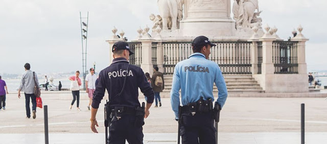

Portugal in 3rd safest country in the world in 2019
Portugal is the third most peaceful country in the world, says the 2019 Global Peace Index. Among European countries, it ranks second, just behind Ice... -
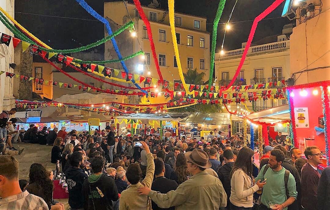
The Festas de Lisboa will have hundreds of free programs. Know them here
Lisbon parties! The most lively June show in the city is about to begin and promises hundreds of free, open-air suggestions every June. &n... -
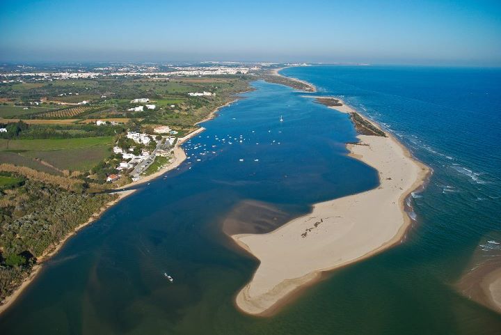
Beach in Cacela Velha is one of the 15 best in the world Portugal Algarve
Praia da Fábrica, also known as Cacela Velha Beach, was considered one of the best in the world by the Spanish edition of Condé Nas... -
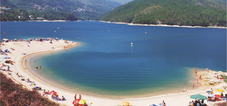
AlqueirĂŁo River Beach in GerĂŞs in Portugal, distinguished with gold quality
This river beach bathed by the intersection of several rivers, including the Cávado, is located in Vilar da Veiga, the largest parish of the mu... -

The beest rooftop bars in Lisbon Portugal
Lisbon is a city of seven hills and, the best terraces of the city so a city of spectacular views. Views across the Tagus River, sweep... -
The Roman Galleries in Lisbon will be open all year from 2020
The news is advanced by the Lisbon City Council, which on Facebook announces the creation of an "interpretive center with access accessible to all via... -

The 12 Best Holiday Resorts in Portugal 2020
As one of Europes top tourist destinations, Portugal is blessed with some truly remarkable vacation resorts. Most of them are along the coast, ... -

Ribeira das Naus River Beach is unique in Europe in central Lisbon
The river beach of Ribeira das Naus is the only beach within a capital city in europe. Take the opportunity to stroll in this riversid...
